Emergency responders in the United States are already stretched thin by a pandemic and western wildfires, and states along the Atlantic coast and the Gulf of Mexico have yet to see the worst of what’s predicted to be an active and potentially destructive hurricane season.
“Things are unfortunately shaping up to be an active hurricane season in the Atlantic, which is probably not what people are wanting to hear,” says Phil Klotzbach, a meteorologist at Colorado State University who specializes in Atlantic Ocean hurricanes.
In an average year, around 12 named storms form—with anything from a tropical storm to a full-fledged hurricane earning an official moniker. This year, forecasters at the National Oceanic and Atmospheric Administration predict that anywhere from 13 to 19 large storms could spin up, with as many as six becoming major hurricanes.
The season has already begun at a breakneck pace. This past weekend, South Texas was inundated with water from Hurricane Hanna, and meteorologists say what will likely become Tropical Storm Isaiah is now rumbling to life just east of the Caribbean.
Colorado State University, which puts out its own seasonal hurricane forecasts, predicts that four major hurricanes–hurricanes Category 3 or higher with winds surpassing 111 miles per hour—will take shape this year.
Why is this season so busy?
A number of climactic conditions can influence how easily hurricanes form, but they essentially boil down to temperature and wind.

Get smart, have fun
Warm water acts like fuel for hurricanes, and sea surface temperatures so far this year along the East Coast, Gulf of Mexico, and Caribbean Sea are well above average. Hurricanes begin as thunderstorms over the ocean. Fueled by heat from warm waters, those thunderstorms create alternating patterns of low and high pressure that continuously pull warm ocean water into the atmosphere. The warmer the water, the more tightly the hurricane spins and the more water it can hold.
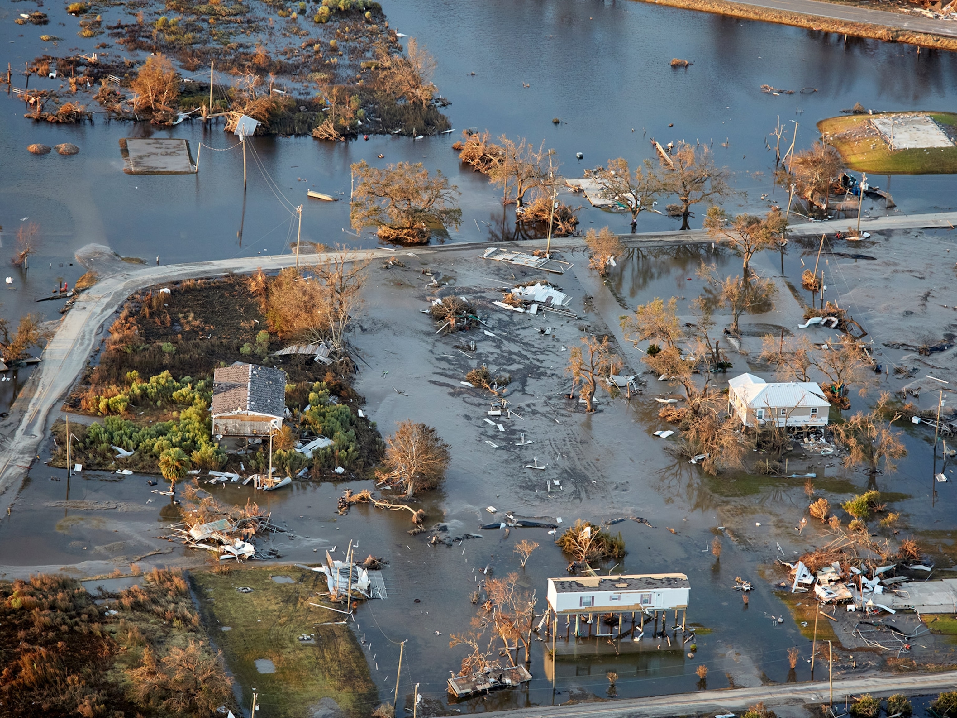
Last year, warm September waters in the Caribbean Sea allowed Hurricane Dorian to dump a devastating amount of rain over the Bahamas.
Currently, Atlantic surface waters are the fourth warmest they’ve been since NOAA began keeping records in 1982. The only years water has been warmer are 2005, 2010, and 2017, which bore witness to Hurricanes Katrina and Maria, two of the most devastating natural disasters to strike the Atlantic basin.
(Ocean heat is also linked to more fires in the Amazon rain forest. Here’s why.)
Winds are also shaping up to be favorable for hurricanes.
Most hurricanes that hit the eastern United States begin as bands of thunderstorms known as tropical waves off the western coast of Africa. Klotzbach says air currently rising up over the continent is likely seeding the strong atmospheric waves that give birth to hurricanes.
So far, the anomalous dust storm that traversed the globe last month has quelled major hurricane formation by slapping storms with dry Saharan air.


“There’s certainly still a lot of dry air around,” notes Klotzbach. However, he notes that this will likely dissipate by mid-August.
Forecasters also closely monitor a weather cycle called the El Niño Southern Oscillation (ENSO) to predict how the Atlantic hurricane season will shake out. El Niño weather patterns are associated with warm, wet precipitation in the western U.S. and eastern Pacific, while La Niña patterns are the inverse—dry, cooler conditions.
“If you’re a hurricane in the Atlantic, you want a warm ocean and as little vertical wind shear as possible,” says University of Miami meteorologist Brian McNoldy. “We currently have a very warm ocean, and if a La Niña does keep coming along it’s expected to relax that wind shear.”
Even though El Niño events take place in the Pacific, their downstream effects on wind shear weaken Atlantic hurricanes. McNoldy says whether a La Niña weather pattern unfolds is the biggest unknown for forecasters.
Hurricanes in the year of climate change and COVID-19
Two of the globe's biggest threats—climate change and the coronavirus pandemic—are, predictably, poised to make hurricanes more deadly.
Studies have shown that sea surface temperatures around the world are increasing on average, as a result of oceans absorbing about 90 percent of the excess heat created by greenhouse gas emissions.
While no one single weather event can be directly linked to climate change, scientists look at how weather is changing over time to understand how emissions are changing weather patterns. One study published in 2018 suggests that warming oceanic and atmospheric temperatures could make storms move more slowly, a phenomenon that would lead to more flooding, because sluggish storms lingering over land would dump more rain. Warmer air also can hold more water.
“There’s a lot of discussion that goes on with hurricanes and climate change but there are still a lot of uncertainties,” says Klotzbach. “The consensus is we may not see more storms but storms that are stronger.”
As the pandemic grounded commercial aircraft, some meteorologists were concerned that losing those vehicles, which carry weather sensing technology and feed the results to forecasting teams around the world, would harm weather forecasts.
Klotzbach says the loss of the aircraft data has had “only marginal” impact on his forecasts, but other meteorologists remain concerned. A study published last month found that forecasting temperature would be more difficult without aircraft. It’s still unclear how much a lack of data will impact our ability to prepare for major hurricanes.
McNoldy says his forecasts haven’t been noticeably impacted by COVID-19 grounding commercial flights and notes that most data fed into weather forecasting models comes from satellites.
In the meantime, emergency responders are currently planning evacuation strategies that allow for social distancing, including housing evacuees in hotels or spacing out cots inside evacuation centers. And the Centers for Disease Control has issued evacuation guidelines that try to limit the spread of COVID-19.
Major storms are often forecast about a week before they hit the coast, and many are known to suddenly veer off course. Klotzbach notes that forecasts can only predict what might happen, saying there’s no guarantee a major hurricane will strike a coastal U.S. city, or that it won’t.
“We can’t say where the storms are going to go months in advance,” he says, adding, “If you have enough of them, you’re probably going to see one of them making nasty landfall.”